


What is shown below is an online map detailing the exact location of all of the Messines mines. Some of these are well known and easy to locate. Others are either slightly hidden, or somewhat tricky to locate 'on the ground' (a small number of those that were 'blown' either left no mark on the surface or have been filled in). Some of the mines were not blown at all, and therefore there is no evidence of there ever being anything going on beneath the surface.
We hope the map below will therefore be not only of interest under the current lockdown, but also help visitors when trips can again be made to the battlefields.
Use your mouse or the plus and minus signs to zoom in and out - this will provide an exact location of each of these locations. Also, by clicking on each of the icons you will be able to see a description and photographs of the location. There are two or three photographs of each of the mines, which can be seen by clicking on the images attached to each of the locations.
Related material:
The following video from the WFA's YouTube channel may be of interest:
Blows below ground: tunnelling operations on the Western Front
Article: Ian Passingham: obituary
Introduction to 'Pillars of Fire': Placing the Battle of Messines Ridge in context by Peter Simkins
Book Review: War Underground by Alexander Barrie
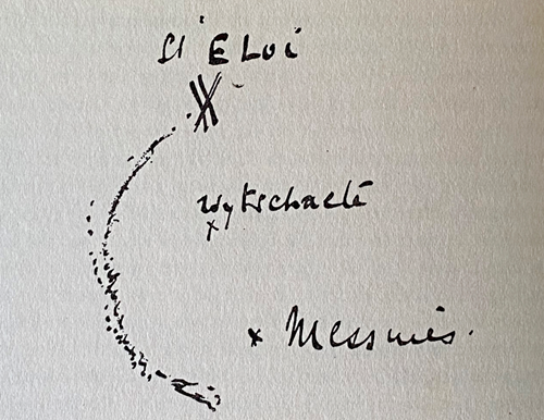
Above: The hurriedly-drawn sketch by Norton Griffiths which started the idea of a great mining attack against Messines Ridge p.90 War Underground
David Tattersfield, Vice Chairman The Western Front Association