


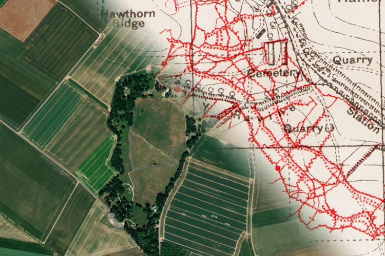
The Western Front Association's cutting-edge portal 'TrenchMapper' which was launched in 2022 with less than 1,000 maps has now hit a major milestone, having grown to contain in excess of 10,000 maps.
More maps are added almost at least twice a week, so the following numbers are only approximate.
We now have 10,064 maps, with 90% of these being of the western front (some 1,500 of these are aerial photos). There are also 370 maps of the Gallipoli campaign of which 45 are aerial photos - here's just one example> The Sphinx, Walker's Ridge, Outpost No. 1, the Nek, Ocean Beach (North Beach) 27/10/1915 - the Gallipoli maps will increasing in number in coming weeks.
With 165 maps of the Italian campaign already published, we are pleased to announce a similar number of Salonika which will soon become available.
In addition there are over 200 maps from the UK we have geo-referenced and made available.
Work carried out by our intrepid band of volunteers continues apace (our thanks to all those working on the project) which means that over coming months further maps will be sourced to further expand the offering.
But it's not just about geo-referencing the maps (the process where we make these 'fit' onto the landscape) we are also busy 'geotagging'. So far we have over 50,000 points captured, (mainly trench names, but also camps and other 'points of interest') - a particular challenge here is in tagging the German trenches (we have thousands of Germans and French maps as well as British ones).
There are a series of articles about different aspects of TrenchMapper available on the WFA's website for people to peruse here> TrenchMapper articles.
Please remember - to obtain the best results (and to zoom 'in' as close as possible) log in to the members' area of the WFA website.