Action shots found on TrenchMapper™
The ongoing work to add content to the WFA's TrenchMapper™ portal goes on, and as well as now having over 7,800 maps and photos loaded we are finding highly interesting images, just a few of which we have highlighted below.
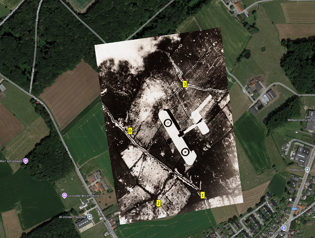
There's several images of aircraft that have been taken from above whilst undertaking missions. In the image below we have the image below, taken just west of the village of La Couture (grid ref 36a.R.34.c.88.31) we think that perhaps it is an escort to the recce aircraft from 21 Sqn RAF which took the picture. (This can be found on image p_005575).

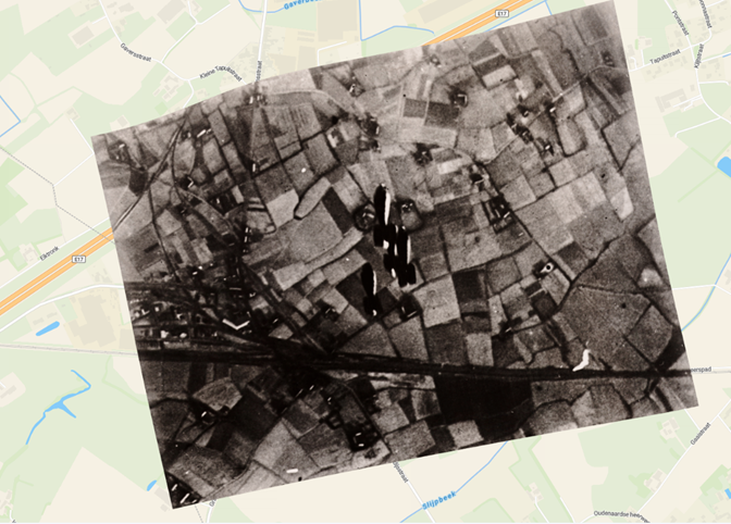
Next, we can see a number of bombs being dropped. Overlaid on the background map, we can identify this as being south of Deerlyk which is east of Courtrai, the image is numbered p_012710.[Add image here]
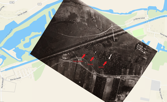
An even better example is below. Taken at Bissinghem, west of Courtrai image p_012709 was 'shot' on 24 March 1918. In it we can see, on close examination, the runways of an airfield just to the right of the aircraft. The bomb (circled by us) is surely being aimed at the runways or hangers.
Next, we can see a number of bombs being dropped. Overlaid on the background map, we can identify this as being south of Deerlyk which is east of Courtrai, the image is numbered p_012710.[Add image here]
An even better example is below. Taken at Bissinghem, west of Courtrai image p_012709 was 'shot' on 24 March 1918. In it we can see, on close examination, the runways of an airfield just to the right of the aircraft. The bomb (circled by us) is surely being aimed at the runways or hangers.

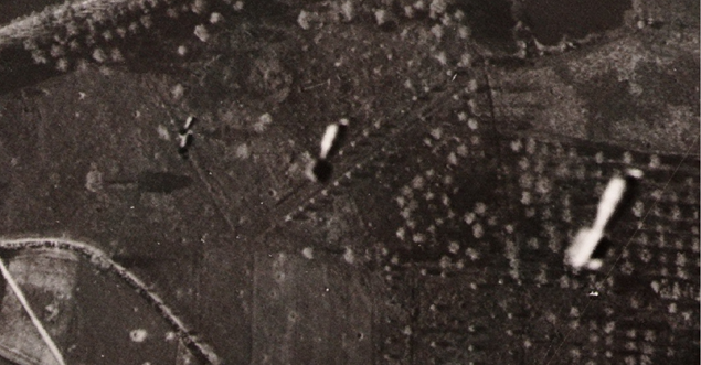
At first we were not totally sure this was in fact a bomb in flight, but by enlarging and then manipulating the image (see below) it became clearer.
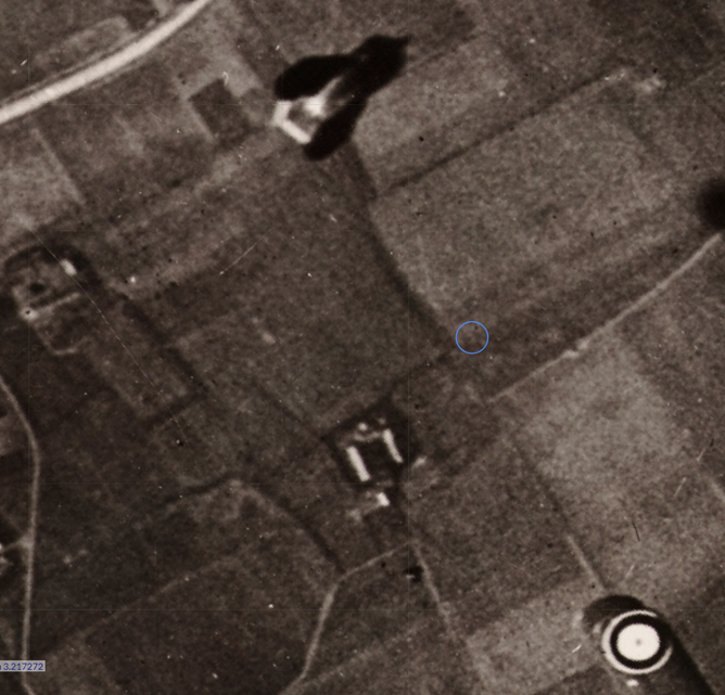
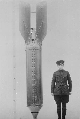
The slight change in orientation and comparing it to the image below made our minds up that this was in fact a bomb, possibly identical to the one shown below.
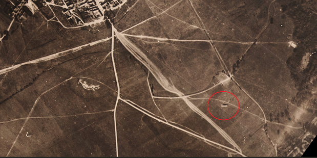
Another example of an air-air photo is below. It is north of Wytschaete (possibly May - Sep 1916) at grid reference 28.O.13.d. Wytschaete is shown at the bottom right
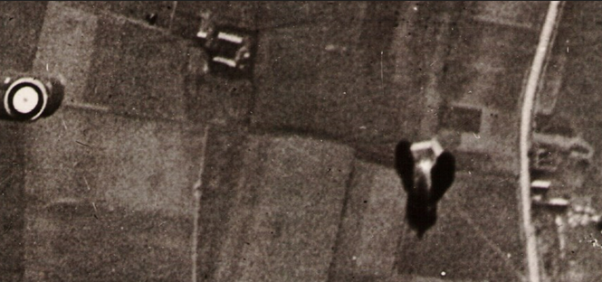
Another example is a 'stick' of bombs being dropped on the bridge at Cerisy in the two images below (the bridge can be seen in the top right on background map) on 19th May 1918. This is map p_019650.
Finally, in this set of examples we have been able to make out a balloon. This was taken to the south-east of Saudemont (south east of Arras) on map 'p_005960' (grid reference 51b.Q.c.70.87).
All of this has brought home to us the skill that was needed by those who interpreted these aerial photographs in the Great War period who obviously didn't have the powerful tools available today, which can be seen using TrenchMapper.


