Maps of the UK available in TrenchMapper™
Although there are not many, TrenchMapper™ does include a number of First World War era maps that cover the UK. These can be seen by going to the 'change theatre' option under the 'menu' button.
Here's just three examples of the maps that are available. All are geo-referenced as usual (so are highly accurate 'on the ground').
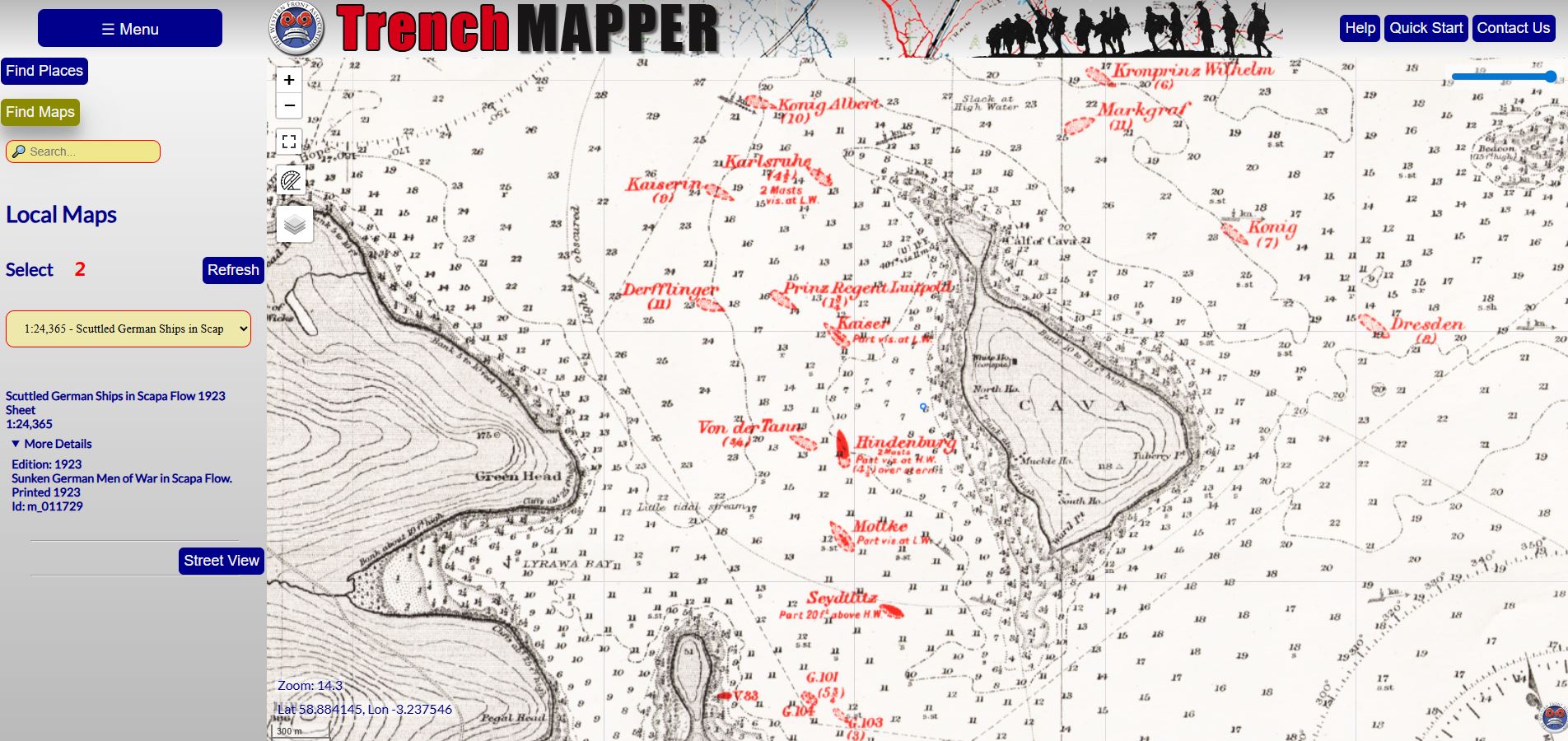
Scapa Flow
The sinking of the German High Seas Fleet in 1919 was mapped at the time as can be seen on the map of the Orkneys. The screenshot below shows the final position of some of the German battleships.
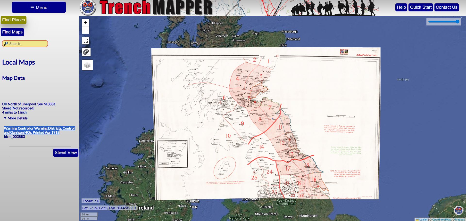
Warning Districts
The actual purpose of this map is not clear, but it is entitled "Warning Control or Warning Districts. Control and Garrison HQs" and was printed in April 1918
Air Raid
The German air raid of 18 December 1917 was tracked on this map.
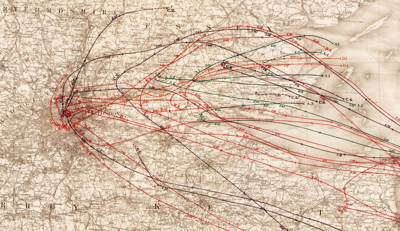
The German air raid on London on December 18, 1917, was a significant daylight attack by Gotha bombers, targeting the capital with explosive and incendiary bombs. Although not the first of these attacks, it was however significant, causing damage in areas like Kentish Town, Charing Cross, Lambeth, and Bermondsey, resulting in about 13 deaths and 79 injuries, highlighting early strategic bombing and civilian impact.
Around 16 Gotha bombers participated, with six reaching London during the day, starting around 7:15 PM. Bombs fell in central areas including Kentish Town, Charing Cross (near Cleopatra's Needle which still bears the scars), Lambeth, Walworth, Bermondsey, and Lincoln's Inn.
Thirteen people were killed and 79 injured in London. There was significant damage to buildings, including shops and houses. One Gotha was shot down by a British fighter.
It was the first large-scale squadron attack on London by these new, long-range bombers, showcasing the new threat of aerial bombardment on civilians.
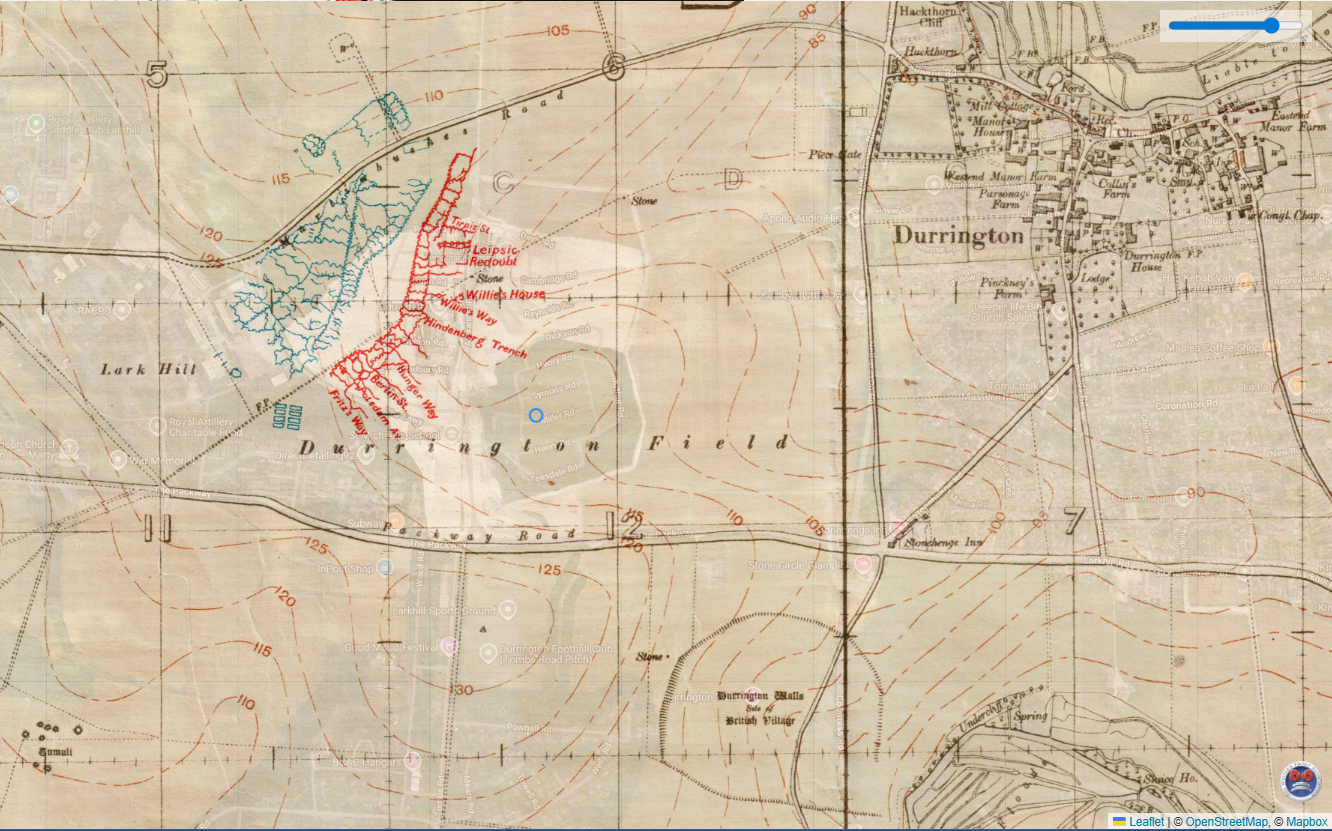
Salisbury plain
This is a map detailing practice trenches on Salisbury plain just to the east of where Larkhill Army base is today.
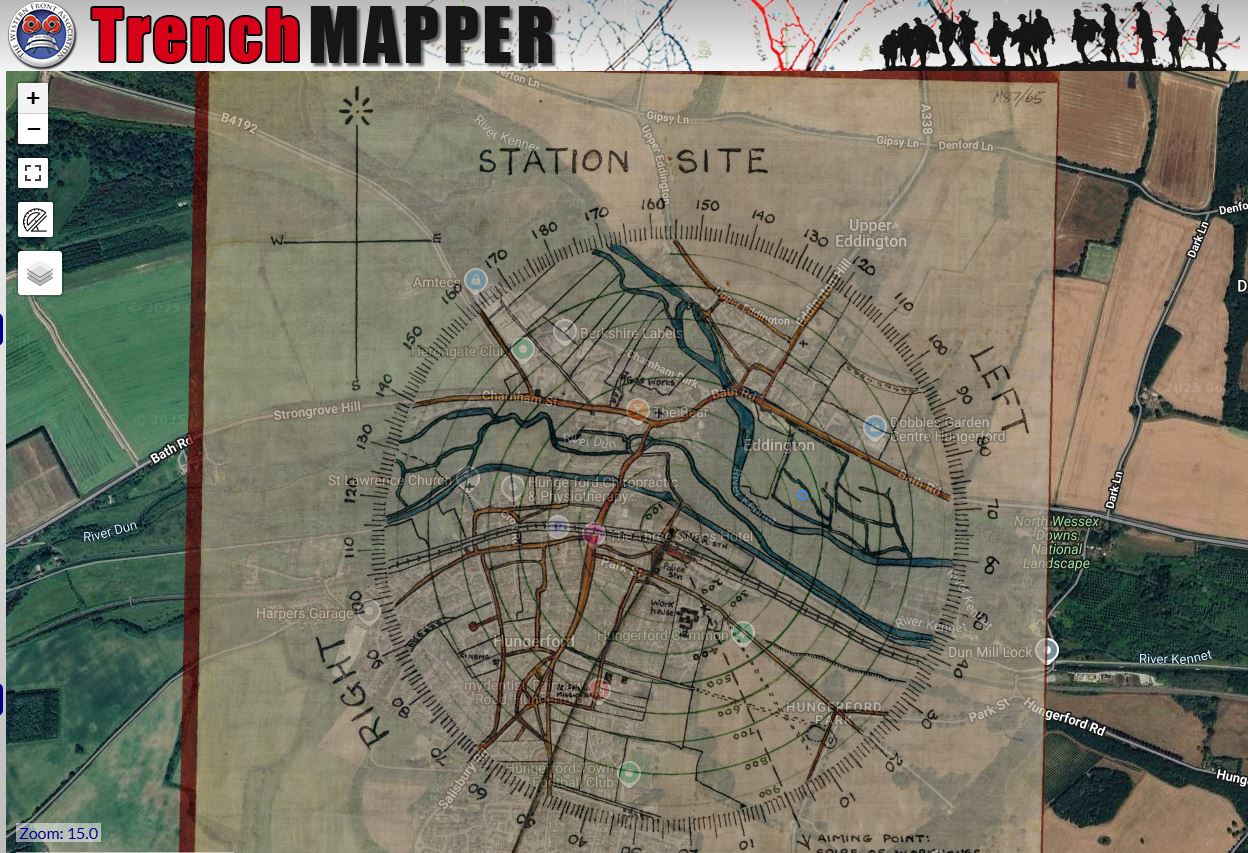
Artillery Training
Part of the Artillery Training series, this map along with others in the series, was used by Martin Brown, Archaeologist to the MOD just before he died to assist in the planning of developments, area clearance and history of the area.
This circular map close to Hungerford is pasted onto hardboard with string at centre and compass bearings around the edge. It is part of the 'Artillery Training' series.
Dover Patrol
This map (or chart) shows part of the blockade by the royal Navy to prevent the German navy from disrupting the vast flow of materiel across the channel to Allied troops. It is dated 31 December 1917.

Although not remotely as abundant as the maps covering the western front, these UK maps are still of interest.