
A 1917 Trench Map Helps Explain a Modern Ground Collapse
More than a century after the end of the First World War, some British military maps continue to serve purposes their original makers could hardly have imagined.
In northern France, the traces left are not confined to the landscape and military cemeteries: they also lie beneath the ground.
Former quarries, mine workings, cellars, underground passages, dugouts, saps and other military structures can create an exceptionally complex subsurface environment. Over time, some of these voids deteriorate and may contribute to ground movement, occasionally in the immediate vicinity of modern homes.
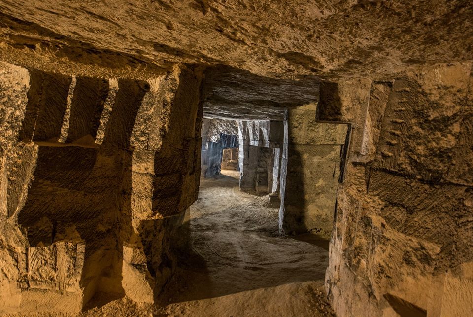
It was in this context that a British military map from 1917, now accessible through TrenchMapper, recently provided useful evidence in an investigation carried out by a French government service.
An investigation that begins beneath the houses
When subsidence or a ground collapse occurs, the consequences can be severe: major cracking, structural deformation, partial settlement of a building or, in the most serious cases, a property becoming unfit for occupation.
But recording the visible damage is only the beginning to understand what has happened; investigators may need to establish what exists — or once existed — several metres below the surface.
In the Pas-de-Calais, this work is undertaken in part by the Direction départementale des territoires et de la mer, or DDTM 62, a French government department responsible for a range of matters including environmental risk and the investigation of underground cavities.
Its specialists bring together information capable of shedding light on the history of the ground beneath a site: plans, archives, old photographs, technical records and other documentary evidence.
Historical research can therefore become an essential part of understanding the origin of ground movement and assessing the risks associated with former underground workings. In some cases, the investigation must go back decades or even centuries.
Mines, quarries… or wartime workings?
In the former mining districts of Nord and Pas-de-Calais, one obvious line of enquiry is the possibility of old mine workings. But not every underground void is a mine gallery.
The ground may also contain the remains of former quarries, cellars, civilian underground structures or military works created during the First World War. The distinction is important technically, but it can also be significant in legal and insurance terms.
Correctly identifying the origin of an underground void can form a crucial part of an investigation.
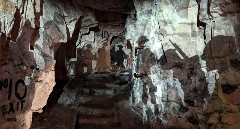
An investigation at Beaumont
It was in the course of such a case that Marie-Laure De Fru, of the Pas-de-Calais DDTM, was required to investigate the possible origin of ground movement in the Beaumont area. (The commune of Hénin-Beaumont came into existence in 1970, the result of a merger of the communes of Hénin-Liétard and Beaumont.)
The historical presence of numerous mine workings in the region naturally provided one avenue of enquiry. But that explanation did not, on its own, account satisfactorily for the situation under investigation. The search therefore had to be widened.
To understand the present-day ground conditions, it became necessary to examine the site as it had existed in the past. In this part of northern France, that inevitably means considering the First World War.
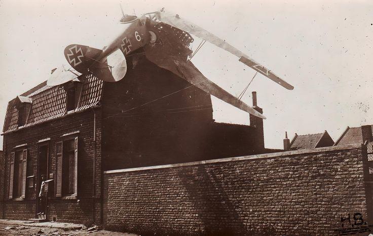
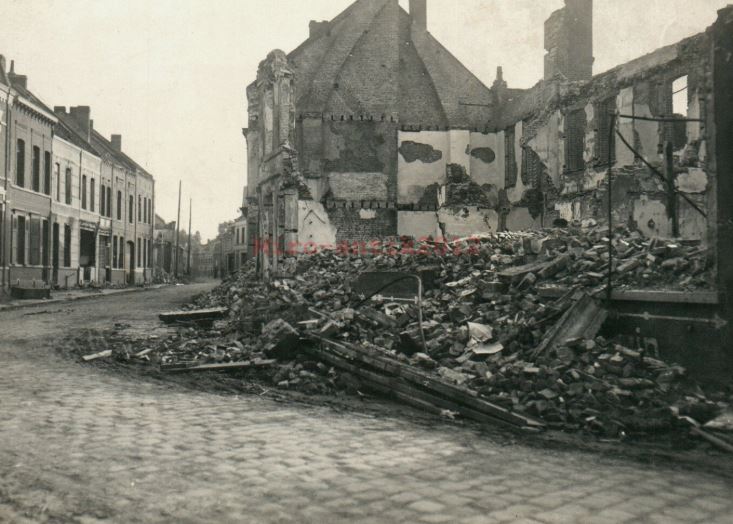
Marie-Laure De Fru is accustomed to comparing modern technical evidence with historical sources, and regularly uses TrenchMapper in the course of her research, particularly when there is a possibility that former military works or wartime alterations to the ground may be relevant. TrenchMapper was therefore not something she discovered solely for this particular case. It had already become one of the documentary resources she consulted when the military history of a site might provide an additional clue.
A British map more than a century old
During the Beaumont investigation, Marie-Laure De Fru once again turned to TrenchMapper.
There she identified a British map dated 1917, reference m_003459, covering the area concerned. It has been created in April 1917 by British First Army Intelligence, and was of the area that was - at the time - behind the German front lines.
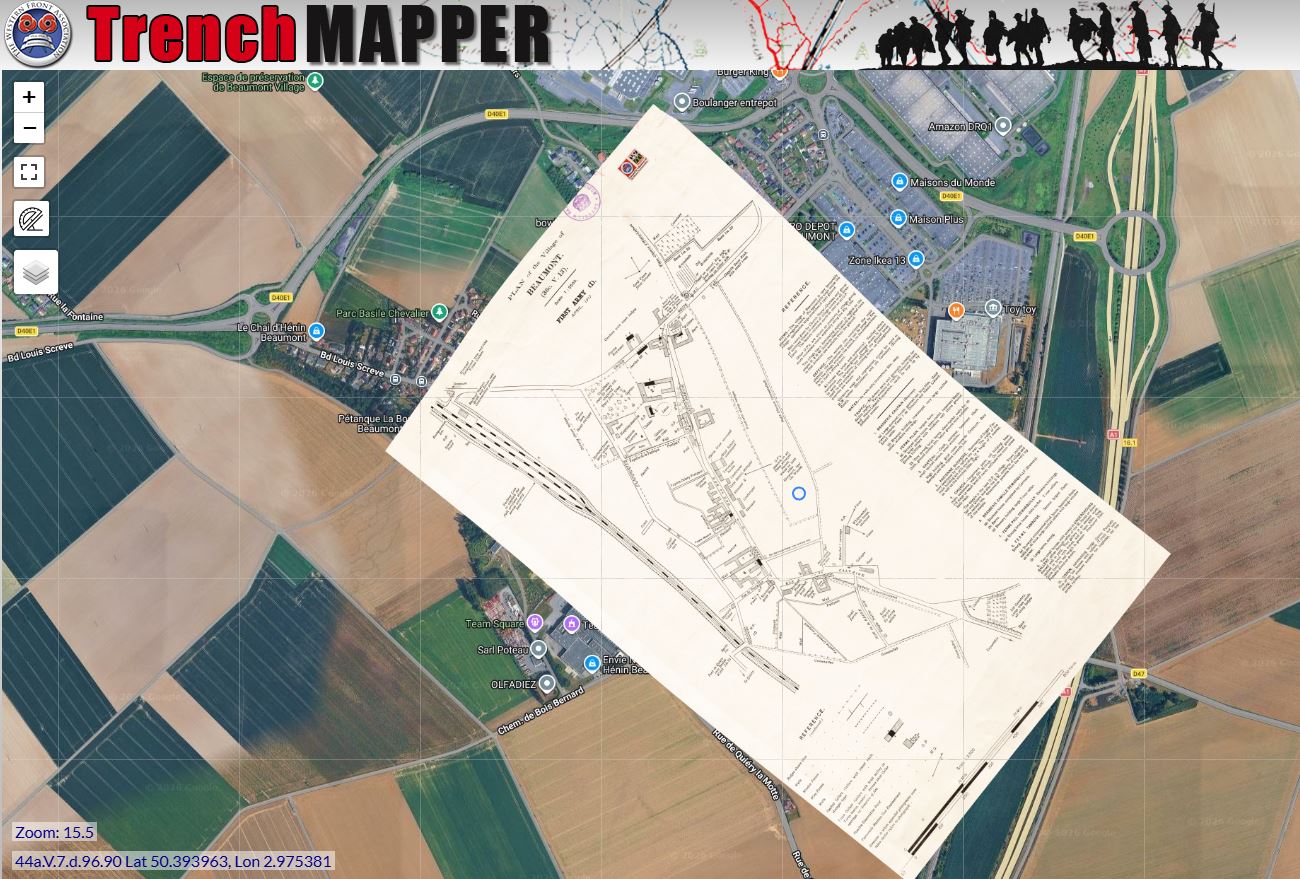
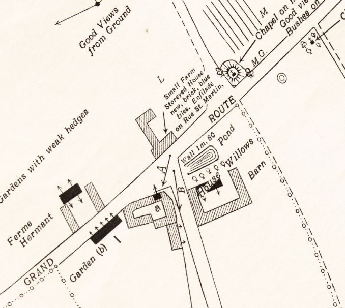
At first sight, it may seem surprising that a document prepared for military purposes more than a hundred years ago should be of interest to a modern government service investigating ground instability. Yet that is precisely where the value of such maps lies.
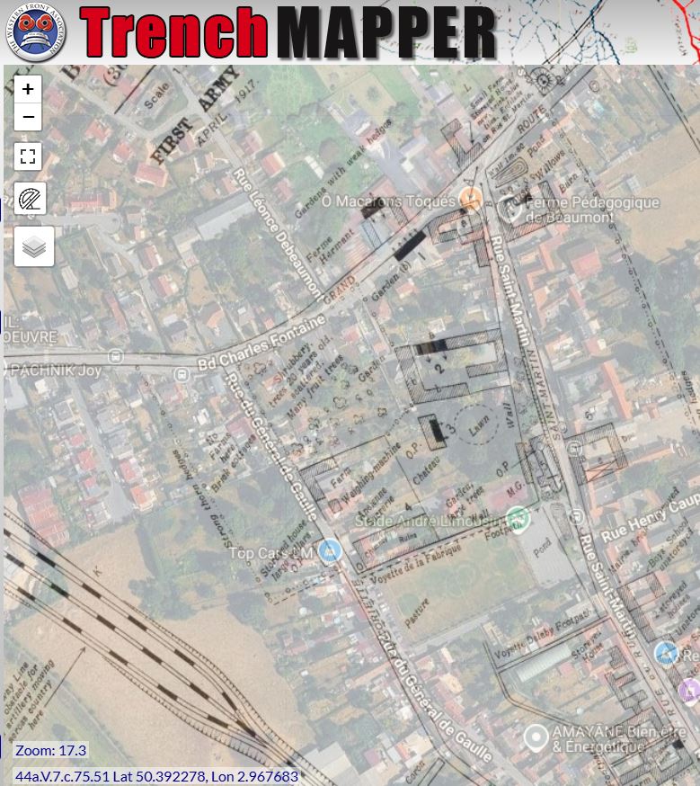
British military maps of the Western Front did far more than show villages and roads. Depending on their date, scale and purpose, they could depict trench systems, communication trenches, shell craters, military positions and numerous topographical features with remarkable precision.
In an investigation concerning ground that may have been altered by past human activity, such a map can reveal information that no modern map preserves.
When military history becomes a technical source
After the war, fields were returned to agriculture, villages rebuilt, roads altered and new houses constructed. But below ground, traces can remain.
For that reason, contemporary military documents may now prove useful well beyond the study of military history.
They can sometimes assist archaeologists, geologists, local authorities and government specialists in understanding how a site has evolved and in identifying possible causes of underground anomalies.
TrenchMapper: a historical archive with unexpected modern uses
Marie-Laure De Fru’s regular use of TrenchMapper, and in particular her consultation of map m_003459 in the Beaumont case, provides a striking example of how a resource created primarily for the study of the Western Front can also have value in modern technical investigations.
The work behind TrenchMapper begins with the preservation, identification and accessibility of historical maps that are often scattered across different collections. They have to be catalogued, digitised, georeferenced and made usable alongside modern geography.
For the First World War historian, the benefits are obvious, a map can help trace the development of a sector of the front, locate a unit, place a war diary in its geographical context, identify the course of a vanished trench, or reconstruct the organisation of a military position. But the Beaumont example shows that the value of these maps can extend further.
A map produced by the Royal Engineers in 1917, created originally to meet the operational needs of an army at war, more than a century later contributed to a French government investigation into the history and stability of a modern site.
The document has not changed. Its purpose has.
A second life for the maps of the Western Front
There is something particularly striking about this continuity.
The men who surveyed, drew, printed and used these maps worked under the pressures of war. Their purpose was military: to understand the ground, locate positions, move troops and prepare operations.
More than a hundred years later, the same sheets can still provide valuable evidence about what may lie beneath the modern landscape.
This is a reminder that First World War archives are not merely records of the past.
They can still act as a memory of the landscape itself.
And the regular use of TrenchMapper by a specialist working for the French authorities demonstrates in a very practical way how the painstaking work of collecting, digitising, georeferencing and making these maps accessible can produce applications that their original creators — and perhaps even the first generations of archivists — could never have foreseen.
Preserving the cartographic record of the Western Front can, more than a century later, still help us understand the landscape of today.
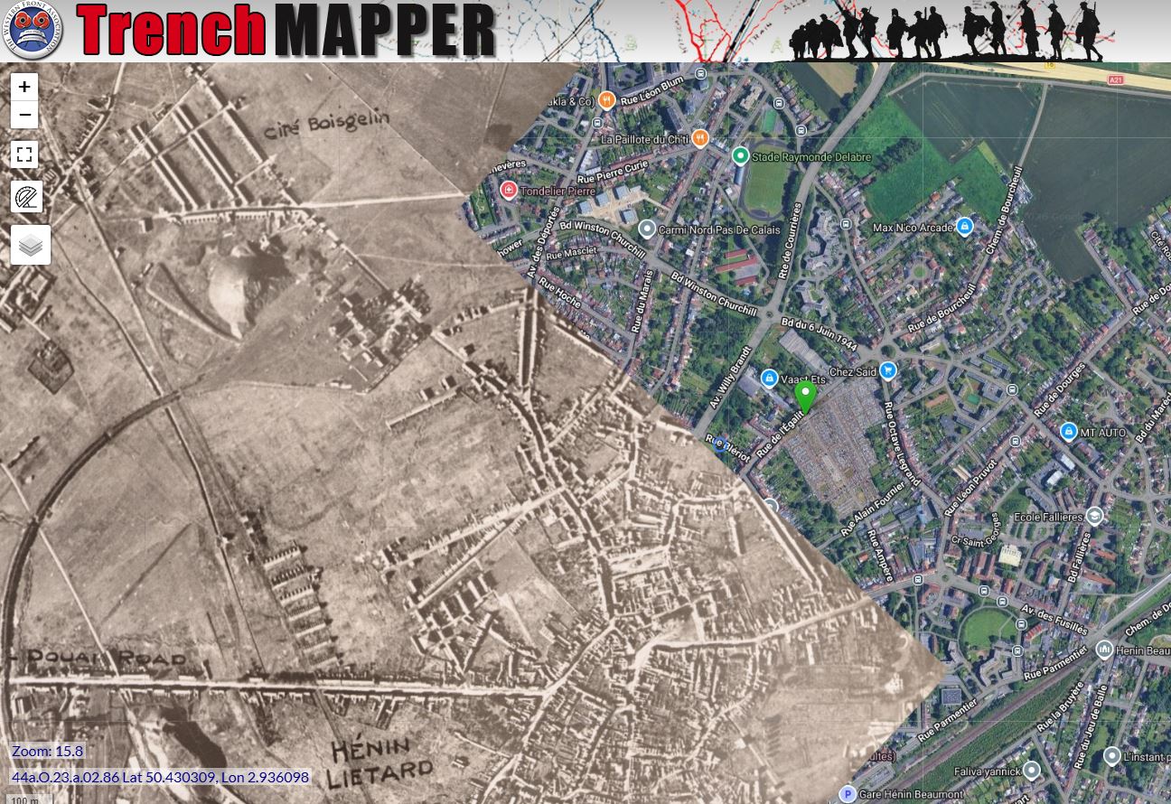
More images
Many more images of Hénin-Liétard and Beaumont during the war can be found on the Hénin-Liétard website


